 Land use diversity by each one mile radius zone in Boston
15-minute Boston
Paris, under their mayor Anne Hidalgo is working to completely transform how people move around their city by introducing the ’15-minute’ city, where all aspects of a person’s life are achievable within a 15-minute walk, bike, or transit ride from their residence.
A project of this scale and magnitude will be required to be staged and completed in phases. If we consider the city of Boston, Massachusetts, how can we adapt this ’15-minute’ city plan here, taking into account its unique strengths, weaknesses, opportunities, and challenges?
Understandably, Boston’s current configuration does not allow for such a situation. Furthermore, a 15 minute walk is significantly shorter than a 15 minute bike ride, and depending on the mode, public transit will take you further than a bike in 15 minutes.
In what ways would Boston’s land-use configuration have to change, to accomodate these requirements? Does it really make sense to concentrate all businesses in one centralized ‘downtown’ area or Financial District?
Analysis
- Can we use POI data to evaluate the accessibility of various 15-minute regions based on population and car ownership?
- Can we create accessibility maps that allow Paris and other cities identify which areas require more amenities to make it eligible under a 15-minute accessible region?
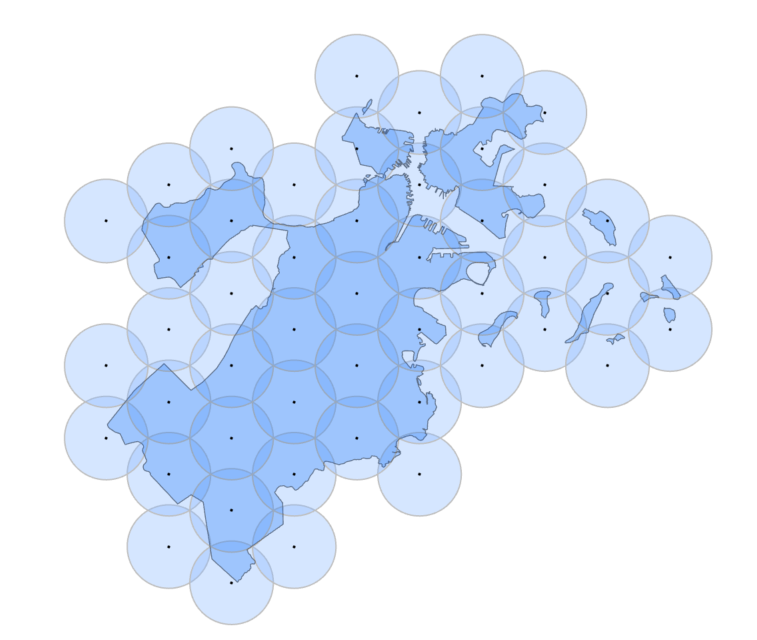
15 Minute Walk Zones
By generating hexagonal tesselations of side equal to 1 mile (the generally accepted distance an average person can walk in 15 minutes) we divide the City of Boston into zones equalling a 1 mile radius. Since the radius of 1 mile is equal to the side of the hexagon, the circumscribed radius is also equal to 1 mile. This effectively creates (for each 1-mile hexagon) up to 6 overlapping zones with neighboring hexagons.
| 1 mile radius hexagons | 1 mile radius overlapping circles |
|---|---|
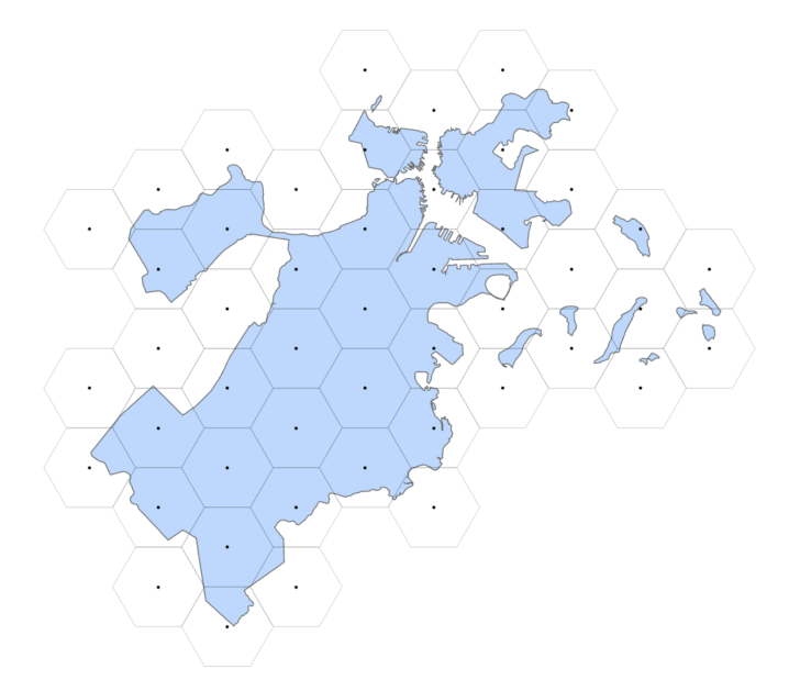 |
 |
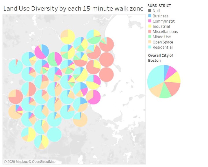
Working with the existing urban layout and physical infrastructure, how do we ensure that all the above mentioned services can be made available within this 1-mile zone? We mapped these two layers together: by getting the proportion of land covered under each major use type, how does each zone compare to the city-wide average?
bos_zones_ratio <- bos_zones %>%
                    select(SUBDISTRIC, area_sqm) %>%
                    group_by(SUBDISTRIC) %>%
                    summarise(area_sqm = sum(area_sqm))

bos_zones_ratio$landuseratio <- (bos_zones_ratio$area_sqm/sum(bos_zones_ratio$area_sqm))*100

bos_15minzones_ratio <- bos_15minzones %>%
  select(TARGET_FID, SUBDISTRIC, area_sqm) %>%
  group_by(TARGET_FID, SUBDISTRIC) %>%
  summarise(area_sqm = sum(area_sqm)) %>%
mutate(landuseratio = (area_sqm/sum(area_sqm))*100)| Land Use for Boston City | Land use proportions |
|---|---|
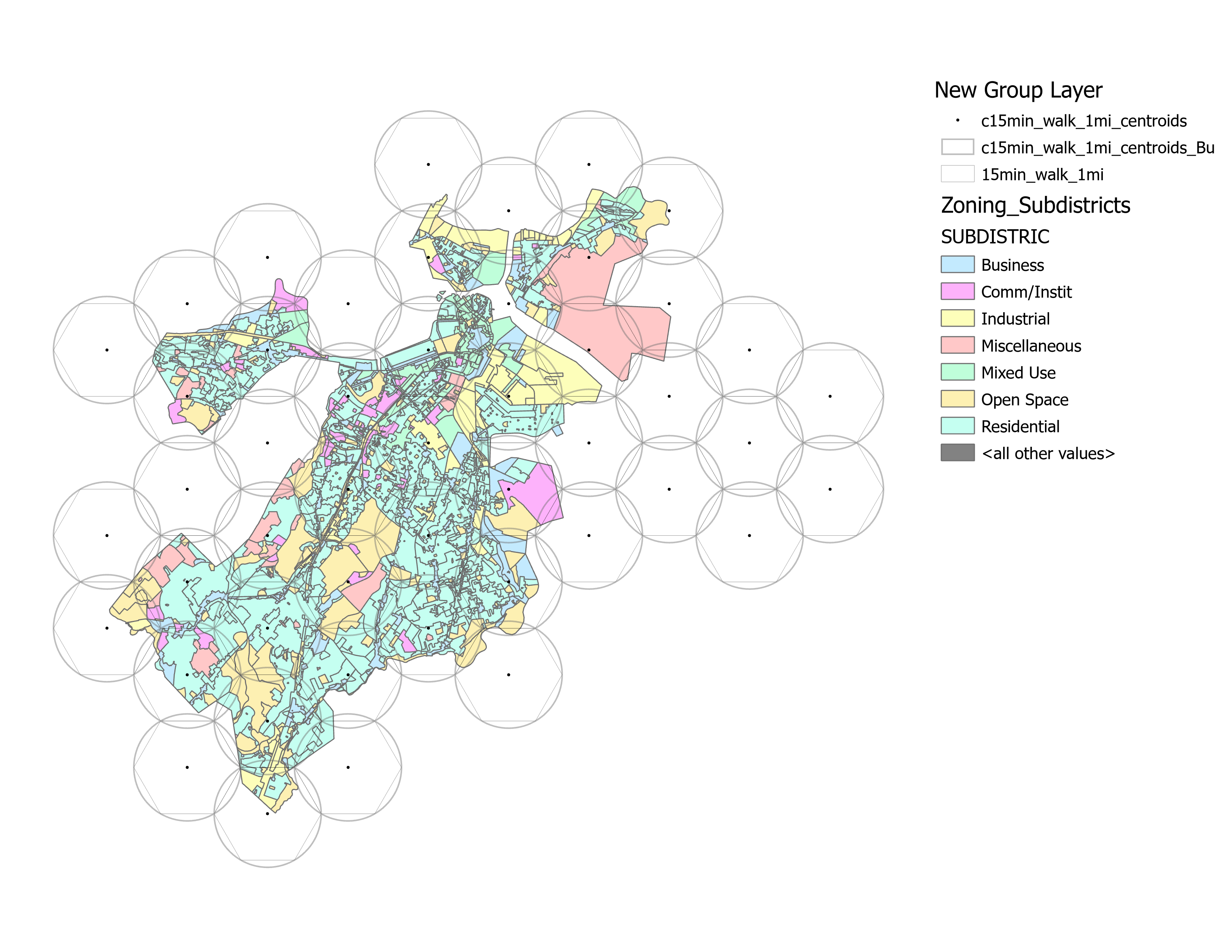 |
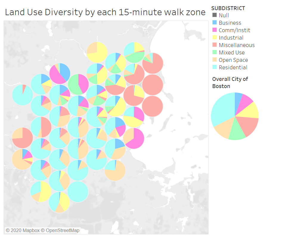 see data on Tableau Public see data on Tableau Public |
What policy, design and planning changes can be made to transform each zone into a self-sustaining 15-minute walk zone?
Narrative * Who and where will interventions make the most difference? * How can we avoid falling into the systematic bias created by 20 th century urban planning? * How can we create a general purpose analysis to evaluate 15-minute accessibility for any city?
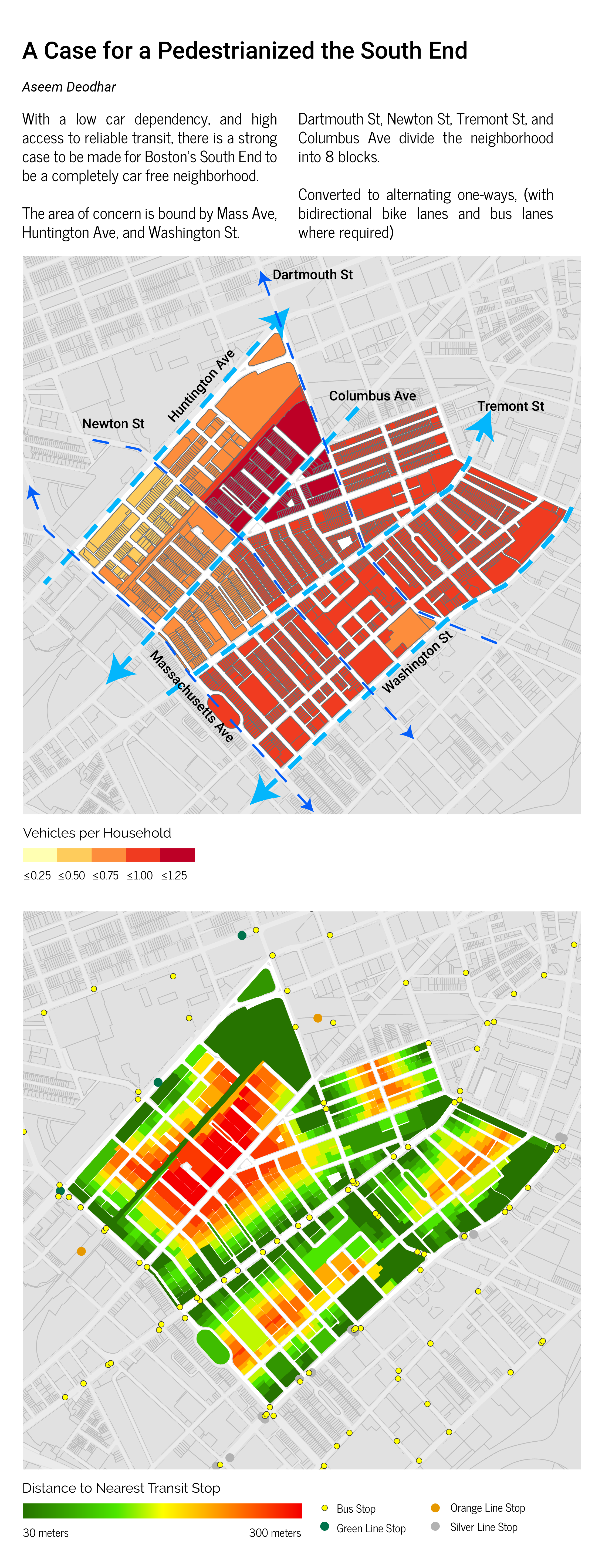
Pedestrianizing the South End:
Boston’s South End creates a strong case for a carfree neighborhood: dense and surrounded by multiple high frequency transit options, it is interestingly placed as a residential neighborhood within the city.
With no residential unit more than 300 meters away from either a MBTAbus, Green line, or Orange line station, the area also has a low car dependency. The area is bound by Mass Ave, Huntington Ave, and Washington St. With Dartmouth St, Newton St, Tremont St, and Columbus Ave dividing the neighborhood into 8 blocks. Converted to alternating one-ways, (with bidirectional bike lanes and bus lanes where required)
Aseem Deodhar
Transportation Planner
My research interests include transit user behaviour, spatial movement pattern analysis, and transportation infrastructure.